Heritage
Yarm Bridge visitor guide
Yarm Bridge is a Grade II* listed stone road bridge carrying the A67 across the River Tees, connecting Yarm to Eaglescliffe. Built around 1400 for Bishop Walter Skirlaw of Durham, it was for centuries the lowest bridging point on the entire river, and remains one of the best places in town to see Yarm Viaduct.
By Yarm.co.uk editorial · Reviewed by Yarm.co.uk editorial · Last reviewed 21 September 2026
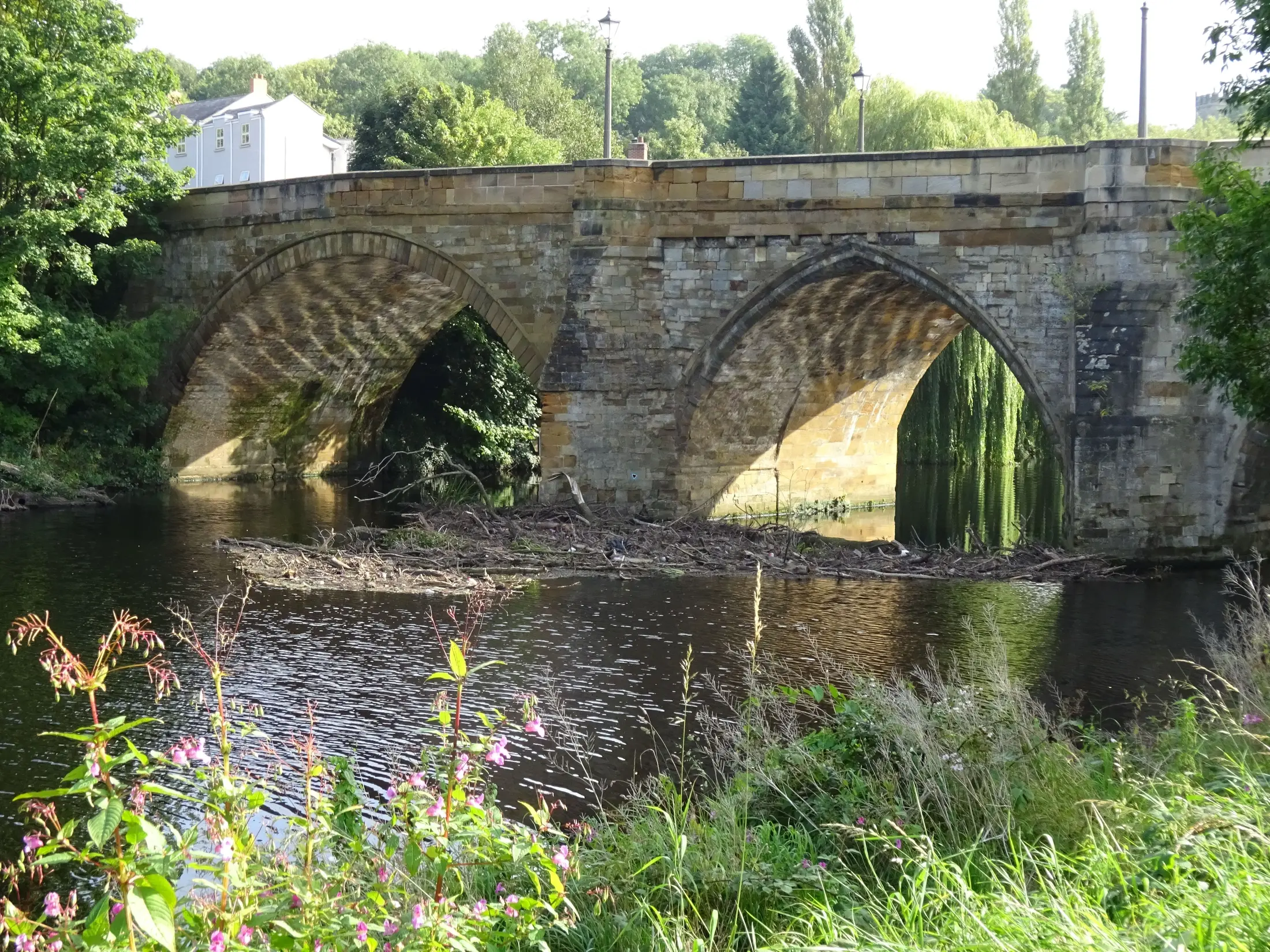
Yarm Bridge — Nosbig Kram, CC BY-SA 4.0, via Wikimedia Commons
Planning summary
Yarm Bridge is a working road crossing built around 1400, still carrying traffic today, and the best vantage point in town for a clear view of Yarm Viaduct. It replaced an even earlier wooden bridge from around 1200, survived a Civil War skirmish and a drawbridge built into its northern arch, and outlasted a replacement iron bridge that collapsed before it ever opened.
The crossing that built the town
Long before the viaduct, before the railway, before most of what stands on Yarm High Street today, there was a simpler problem: how to get across the River Tees at all. The earliest known answer was a wooden bridge, built around 1200. It lasted roughly two centuries before Walter Skirlaw, Bishop of Durham, commissioned a stone replacement around 1400, the bridge that, in modified form, still carries traffic today.
For more than 300 years afterwards, it held a remarkable distinction: it was the lowest crossing point on the entire River Tees. Anyone travelling by road between Yorkshire and County Durham had no real choice but to pass directly through Yarm, and that monopoly is a large part of why the town grew as wealthy and busy as it did. It only ended in 1771, when Stockton finally built a bridge of its own. See the separate Yarm Bridge attraction record for a shorter, quick-reference version. Read the wider story of the town in the History of Yarm guide. Crossing from the Egglescliffe side brings you straight onto the northern end of the High Street, where the Yarm Town Hall record picks up the story of the market the bridge once fed, and the street's independent shops begin within a few minutes' walk.
A drawbridge, a battle, and a bridge that collapsed
The bridge has seen real drama over the centuries. During the English Civil War in 1643, Royalist troops defending the crossing tore out its northernmost arch and replaced it with a drawbridge, a genuine military fortification built directly into the town's main river crossing, which stayed in place until 1785.
In 1805, an attempt to replace the ageing stone structure with a new iron bridge went badly wrong. The new bridge collapsed before it was ever opened to traffic, in January 1806. The original stone bridge, which had never actually been demolished, was simply widened instead, to 7.3 metres, and has carried Yarm's traffic ever since.
The best place in town to see the viaduct
Yarm Bridge sits close enough to Yarm Viaduct that the two are almost impossible to separate in any view of the town from the water. The architectural historian Nikolaus Pevsner, writing in his authoritative Buildings of England series, described arriving in Yarm over this exact bridge and finding the viaduct immediately alongside it, describing the pairing as a natural introduction to the town for anyone approaching from the north.
Today the bridge carries the A67 and remains Grade II* listed, one rung above the viaduct's own Grade II status, recognising its exceptional historic importance. Read the viaduct's own history in the Yarm Viaduct visitor guide. Check current arrival and parking information in Planning your visit to Yarm.
Using the bridge today
The bridge carries live road traffic, so keep to the pedestrian space and take care near the carriageway, especially if you are stopping to take a photograph of the viaduct. It is not a pedestrianised viewpoint, and the road surface should always be treated as an active crossing rather than a place to linger.
Combine a stop at the bridge with a wider walk through the town centre. The High Street, Town Hall and viaduct all sit within easy reach, and the bridge itself is a natural start or end point for a short loop around Yarm's historic core. Browse Yarm's Eat & Drink listings for somewhere to stop afterwards, or check places to stay near Yarm for a longer visit. Return to the Guides hub for the full itinerary and planning guides.
Frequently asked questions
How old is Yarm Bridge?
The current stone bridge dates to around 1400, replacing an earlier wooden bridge from around 1200.
Is Yarm Bridge listed?
Yes. Historic England records it as Grade II* under National Heritage List entry 1105658, one grade above Yarm Viaduct.
Is Yarm Bridge still used by traffic?
Yes. It carries the A67 road across the River Tees between Yarm and Eaglescliffe and remains a working crossing today.
Where is the best place to see Yarm Viaduct?
Yarm Bridge itself. It sits close enough to the viaduct to offer one of the clearest views in town.
Did Yarm Bridge ever have a drawbridge?
Yes. A drawbridge was built into its northern arch during the English Civil War in 1643 and remained until 1785.
Was there ever a different bridge at Yarm?
An attempt to replace the stone bridge with an iron one in 1805 collapsed before it opened in January 1806. The original stone bridge was widened instead.
Sources
- Historic England: Yarm Bridge, entry 1105658 — Official identity, Grade II* designation and list dates.
- Wikipedia: Yarm Bridge — Construction dates, 1805 collapse, and 1806 widening.
- Cleveland & Teesside Local History Society: The Building of Yarm Bridge, 1400 — Earlier wooden bridge, Bishop Skirlaw commission, and the bridge's role as the lowest Tees crossing.
- Bridges on the Tyne: Yarm Road Bridge — Civil War drawbridge detail and Pevsner quotation on the viaduct view.
Retrieved 21 September 2026. Live links used for pre-travel checks.