Yarm visitor guide
Plan a visit to Yarm
This Yarm visitor guide hub helps you turn transport, food, shopping and landmarks into a workable visit. Start with the question you need to answer: how to arrive, how to organise one day, or how to understand and view Yarm Viaduct lawfully. Each guide separates stable context from details that should be checked shortly before travel.
Last reviewed 21 September 2026
Featured planning guide
Itinerary
One day in Yarm
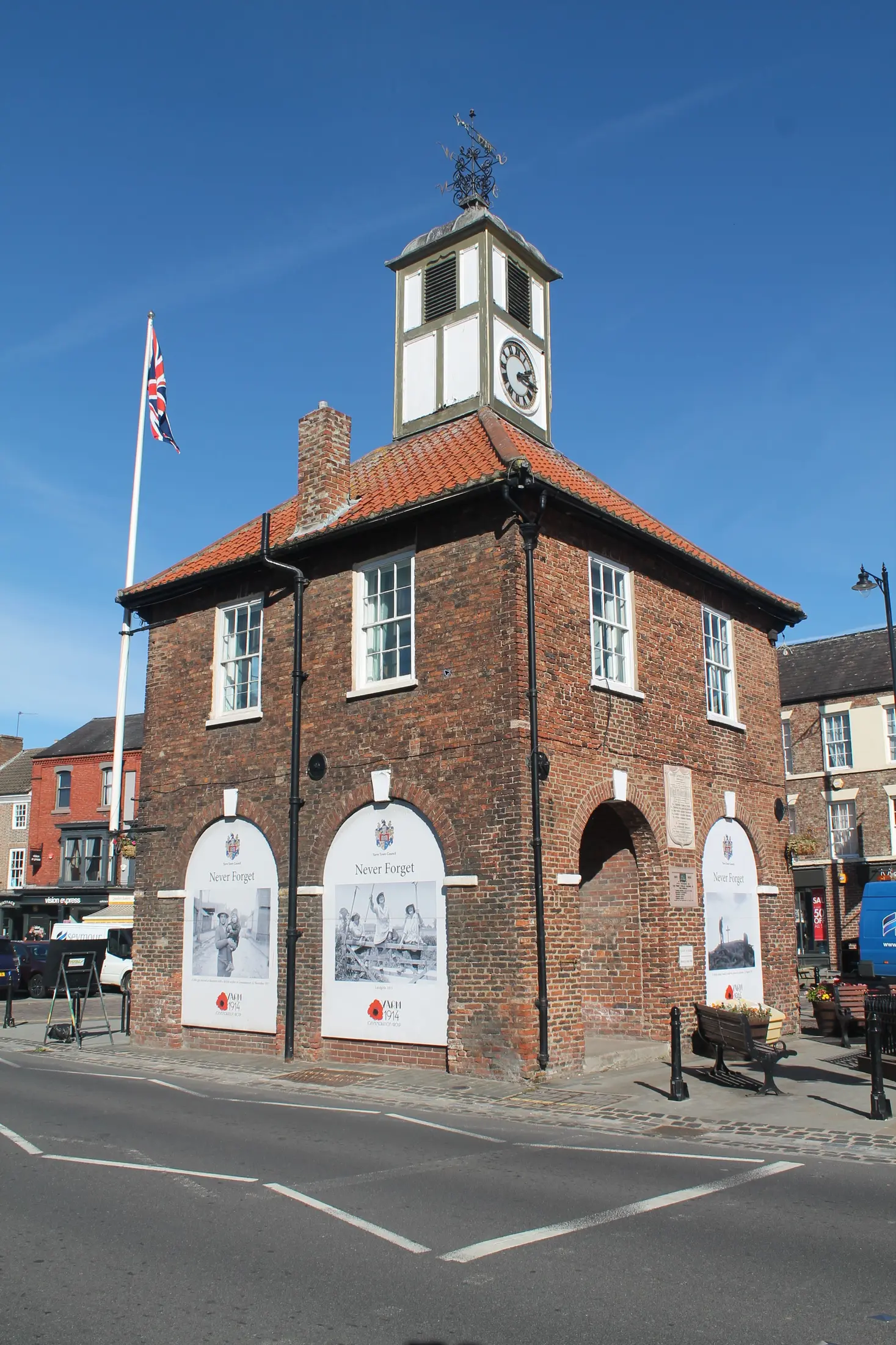
One day in Yarm works best as a flexible town-centre plan: settle the journey first, use the High Street and Town Hall as orientation points, choose food and shopping from current listings, then add the bridge, river or viaduct only where present access and conditions suit you.
Read the guide →Who the Yarm Guides are for
The Guides are for visitors who have moved beyond asking what exists and need to decide how a visit will work. A first-time day visitor may need arrival, parking and orientation in one place. A returning visitor may want to combine a meal with shopping or an event. A railway or heritage enthusiast may want accurate context without being sent onto an unsafe or unverified route. Families and mobility-impaired visitors need clear prompts about what must be checked, not confident assumptions based on a map.
This planning role is deliberately different from a directory. The Guides do not reproduce every restaurant, shop, accommodation provider or attraction. They explain when those choices fit, which live information affects them, and how the High Street, Town Hall, River Tees, Yarm Bridge and Viaduct relate. Where a business decision is required, the relevant current category page is the next step, followed by direct confirmation with the provider.
- If you already know the visit will last a day, begin with One day in Yarm.
- If transport or parking is the main uncertainty, open Planning your visit to Yarm.
Choose the right Guide
Use the itinerary when you want a flexible morning, lunch and afternoon structure. It keeps individual business selection current by linking to food, shopping and accommodation sections, and it offers a High Street-centred alternative when riverside access or weather is uncertain. Use the logistical Guide when the journey, station facilities, parking duration, Blue Badge rules or Passenger Assistance will determine what is practical.
Use the Viaduct Guide when engineering and railway history are a main interest. It combines Grade II designation, Victorian construction, 43-arch scale and the modern £8.2 million strengthening project with firm safety limits. It does not present the operational structure as a visitor walkway or guarantee a viewpoint. If weather or access changes, move to the High Street-centred advice instead.
- For sourced engineering context and lawful viewing advice, read the Yarm Viaduct visitor guide.
- For concise attraction discovery rather than logistics, browse things to do in and around Yarm.
Quick orientation: how Yarm’s central landmarks relate
Yarm Town Hall stands on the High Street and works as a clear orientation point. Historic England dates it to 1710 and lists it at Grade II. Yarm Bridge crosses the River Tees and is a separate Grade II* structure dated to about 1400. Yarm Viaduct is the long Grade II Victorian railway structure that crosses the river and continues through the townscape. It opened in 1852 and remains in railway use.
Historic England grid references place Town Hall and Yarm Bridge about 317 metres apart in a straight line, Town Hall and Viaduct about 343 metres apart, and bridge and Viaduct about 73 metres apart. These calculated relationships explain why the landmarks can be understood together. They are not walking distances, do not certify an accessible route and do not show that every riverside path is open. Follow lawful public routes and current signs.
- Learn about the civic orientation point in the Yarm Town Hall visitor record.
- Distinguish the road crossing from the railway structure with the Yarm Bridge visitor record.
Arrival choices shape the visit
Rail visitors should use live journey information and check Yarm station facilities before leaving. National Rail lists YRM on Green Lane, step-free access to all platforms, Passenger Assistance meeting points, ticket machines, Help Points and waiting facilities; it does not list a staffed ticket office or refreshments. That station information does not establish the accessibility of the onward route into town. Bus visitors should confirm their stop and return through a live planner rather than relying on frozen route numbers.
Drivers should choose parking for the intended duration. As at 21 September 2026, Stockton-on-Tees Borough Council distinguished time-limited High Street parking from five named long-stay car parks. Charges and restrictions are volatile and no listing guarantees a space. The visit-planning Guide dates each displayed tariff, attributes station capacity separately to National Rail, and explains the different Blue Badge treatment for High Street and long-stay parking.
- Check current logistical detail in the complete Yarm travel and parking guide.
- If arrival is built around a dated activity, review What’s On in Yarm before booking transport.
Plan a short visit, full day or overnight break
A short visit works best with one purpose: a meal, focused shopping, an appointment, or one exterior landmark alongside the High Street. Protect the return journey and match parking to the actual stay limit. A full day can support a meal, browsing and one heritage emphasis without requiring an invented walking loop. An overnight break can add an event or longer dinner, but accommodation, check-in, parking and next-day transport need direct verification.
These are editorial frameworks, not claims that every visitor needs the same duration. Weather, mobility, business opening and river conditions can change the sensible plan. A compact-looking centre should not be used to infer gradients, surfaces or accessibility. The Guides offer choices that can be removed without collapsing the day: the High Street remains a workable core when an exterior extension is unsuitable.
- Choose current accommodation through places to stay in and around Yarm.
- For a flexible full-day sequence, follow the Yarm day-trip itinerary.
Use the main site sections at the right point
Things to Do should create interest and help identify attractions; the Guides explain how to fit selected interests into time and transport. Eat & Drink and Shopping provide current choices; the itinerary explains where a meal or browsing period can sit without endorsing a “best” business. What’s On supplies dated activities that may alter arrival or return plans. Places to Stay supports an overnight decision, while the Local Directory helps locate individual services.
Use each section for the job it does best. Select a category, follow its canonical business record, then confirm opening, availability, accessibility or facilities directly when those details matter. An Apify-derived directory record can support discovery and internal linking, but it is not proof of current trading status or a particular facility. The Guides explain when those choices fit into a visit rather than copying records into prose.
- Choose a current meal option through Eat & Drink in Yarm.
- Plan a browsing period with the Shopping section.
- Find individual services in the Yarm local directory.
Plan for information that changes
Train times, bus journeys, parking charges, restrictions, event status and business details are volatile. Check them close to travel even when this Guide displays a review date. Parking figures are visibly dated and linked to the council; station facilities are attributed to National Rail; no static bus timetable is reproduced. Historical designation and engineering facts need less frequent review, but should still be revisited if a responsible source changes.
Save live pages, confirm essential bookings and keep a fallback. A wet-weather option, alternative lawful parking location or earlier return can prevent one change from spoiling the trip. Signs and responsible-authority information at the location take priority over an editorial summary. Report a discrepancy through the site so the evidence register can be reviewed rather than silently updating one paragraph without its supporting claim.
Accessibility and local verification
Check each stage of an accessible journey separately. A station classification does not cover the onward pavement, a riverside path, a business entrance or the return journey. Confirm Passenger Assistance where needed, ask venues directly about current arrangements, and treat an attractive route as unverified for wheelchairs, pushchairs or travel after dark unless a responsible source says otherwise. The Guides do not turn geographical proximity into an access promise.
Riverside access, including True Lover’s Walk, should be checked locally before it becomes essential to the plan. Follow lawful public routes and current signage. Yarm Viaduct has no visitor access: never enter railway land, maintenance compounds or climb the structure. Photography must not obstruct roads, pavements, residents or railway operations. These boundaries protect the practical purpose of the Guides without discouraging a well-planned exterior visit.
- Review operational-railway boundaries in the Yarm Viaduct planning guide.
Choose your Yarm Guide
Each Guide solves a different visitor-planning problem while linking back to current category information.
Heritage
Yarm Viaduct visitor guide
Yarm Viaduct is a Grade II listed Victorian railway viaduct carrying trains across the River Tees since 1852. It has 43 arches and runs for roughly 690 metres, nearly the full length of the town. There is no public access to the structure itself, but it can be seen clearly from the streets below, especially Yarm Bridge.
Read the guide →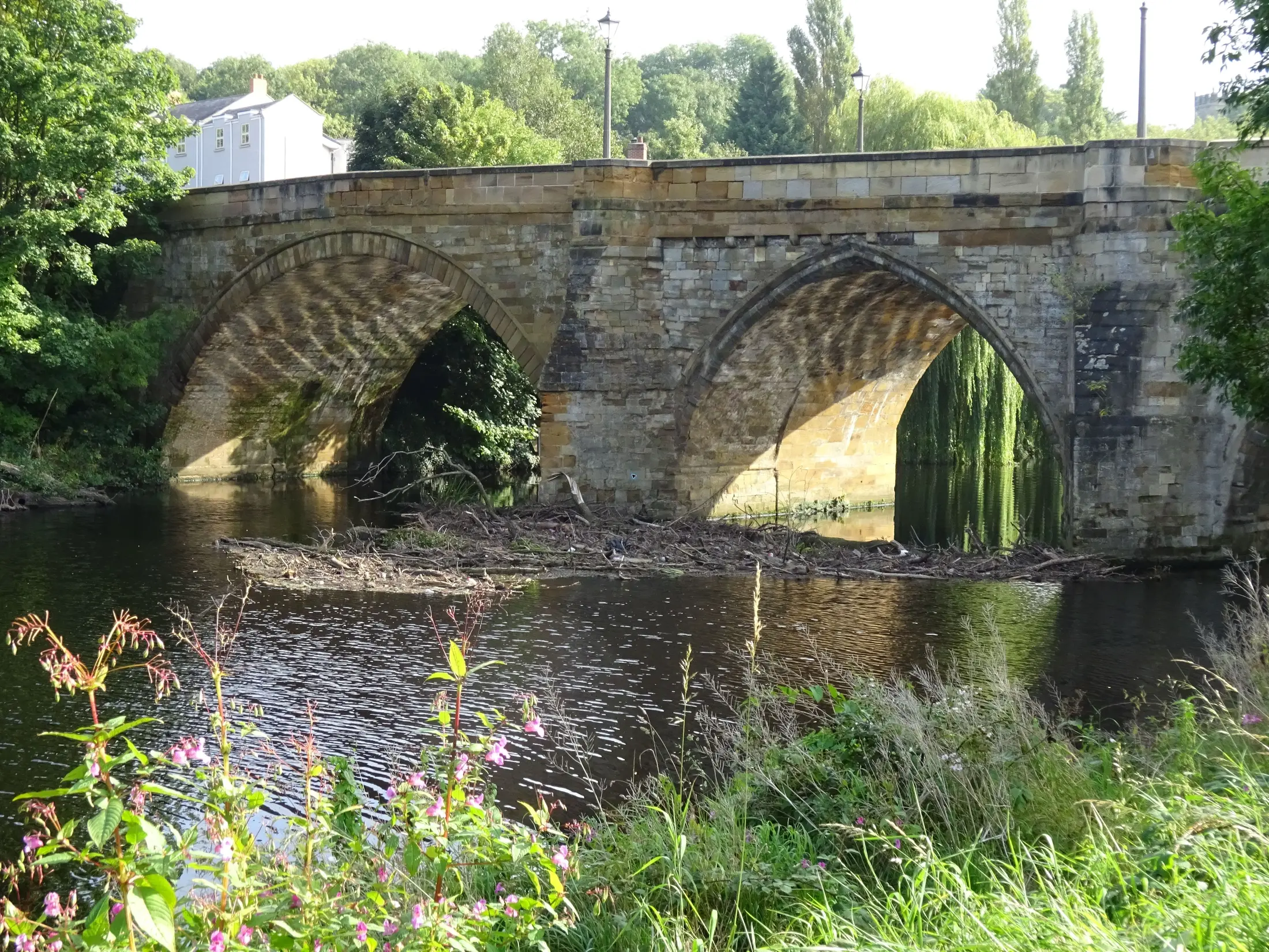
Visitor information
Planning your visit to Yarm
Planning a visit to Yarm means choosing transport around the shape of the day. Use live rail or bus information, match car parking to the intended stay, and verify assistance, weather, events and venue details before leaving. This guide dates volatile station and parking information to 21 September 2026.
Read the guide →Heritage
Yarm Bridge visitor guide
Yarm Bridge is a Grade II* listed stone road bridge carrying the A67 across the River Tees, connecting Yarm to Eaglescliffe. Built around 1400 for Bishop Walter Skirlaw of Durham, it was for centuries the lowest bridging point on the entire river, and remains one of the best places in town to see Yarm Viaduct.
Read the guide →Heritage
History of Yarm
Yarm appears in the Domesday Book of 1086 and was held directly by the King of England before passing to the ancestors of Robert the Bruce. Its royal market charter dates to 1207, its bridge to around 1400, and in 1821 a meeting at a Yarm pub secured approval for the world's first public railway.
Read the guide →Property
Property for Sale in Yarm
Land Registry data for the TS15 postcode district shows average sale prices peaked at £360,759 in 2024 before easing to £347,629 in 2025. Freehold sales dominate at 91%, and new-build homes have typically sold for around 29% more than comparable existing homes.
Read the guide →Frequently asked questions
Which Yarm Guide should I read first?
Start with Planning your visit to Yarm if transport, station facilities or parking determine the trip. Start with One day in Yarm if arrival is settled and you need a flexible itinerary.
Are the Guides another business directory?
No. They explain how to organise time and combine choices. Current businesses remain in the Eat & Drink, Shopping, Stay and Local Directory sections.
Can I rely on the displayed parking prices?
They are dated to 21 September 2026 and sourced to Stockton-on-Tees Borough Council, but parking is volatile. Confirm the current page and signs before travel.
Does Yarm station have step-free access?
National Rail lists step-free category A and step-free access to all platforms. That does not establish accessibility of the onward route or individual venues.
Can visitors go onto Yarm Viaduct?
No. It is operational railway infrastructure with no visitor access. Remain in lawful public places and never enter railway land or maintenance areas.
Do the Guides guarantee a riverside route?
No. Check current access, signs and local conditions before relying on True Lover’s Walk or another riverside path, and keep a High Street-centred alternative.
Sources and review information
The detail Guides cite Historic England, Network Rail, National Rail and Stockton-on-Tees Borough Council beside the claims they support. Research was supplied as independently retrieved on 21 September 2026. Parking information is reviewed monthly; station information within three months; stable heritage facts annually. Always use the linked live sources for details that may change.